Real Archshaper Site Analysis examples
Architecture begins with understanding the place. Building footprints, transport networks, waterways, land use and environmental conditions can each tell a different story about the same site. Archshaper brings these views together around one selected project location so your diagrams remain consistent across an architecture presentation.
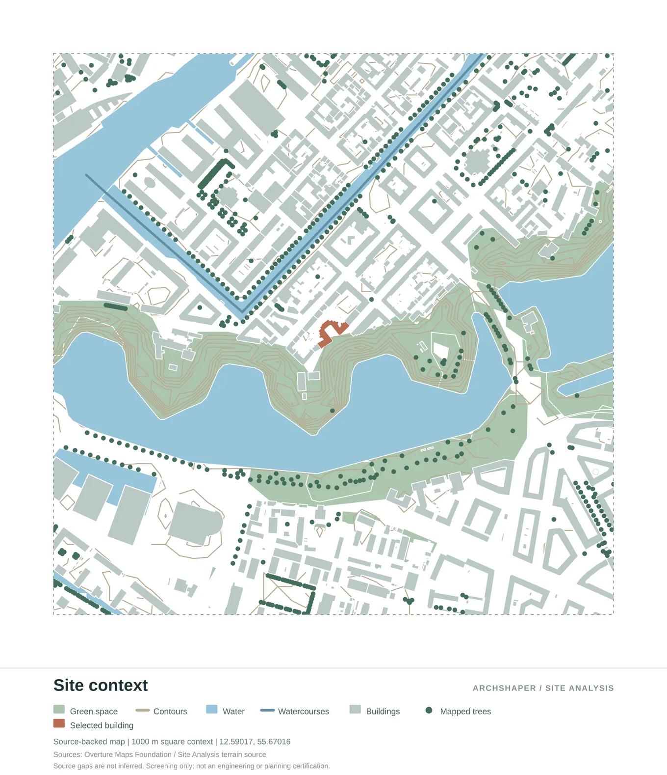
Buildings, streets, landscape, waterways and the selected project site in one map.
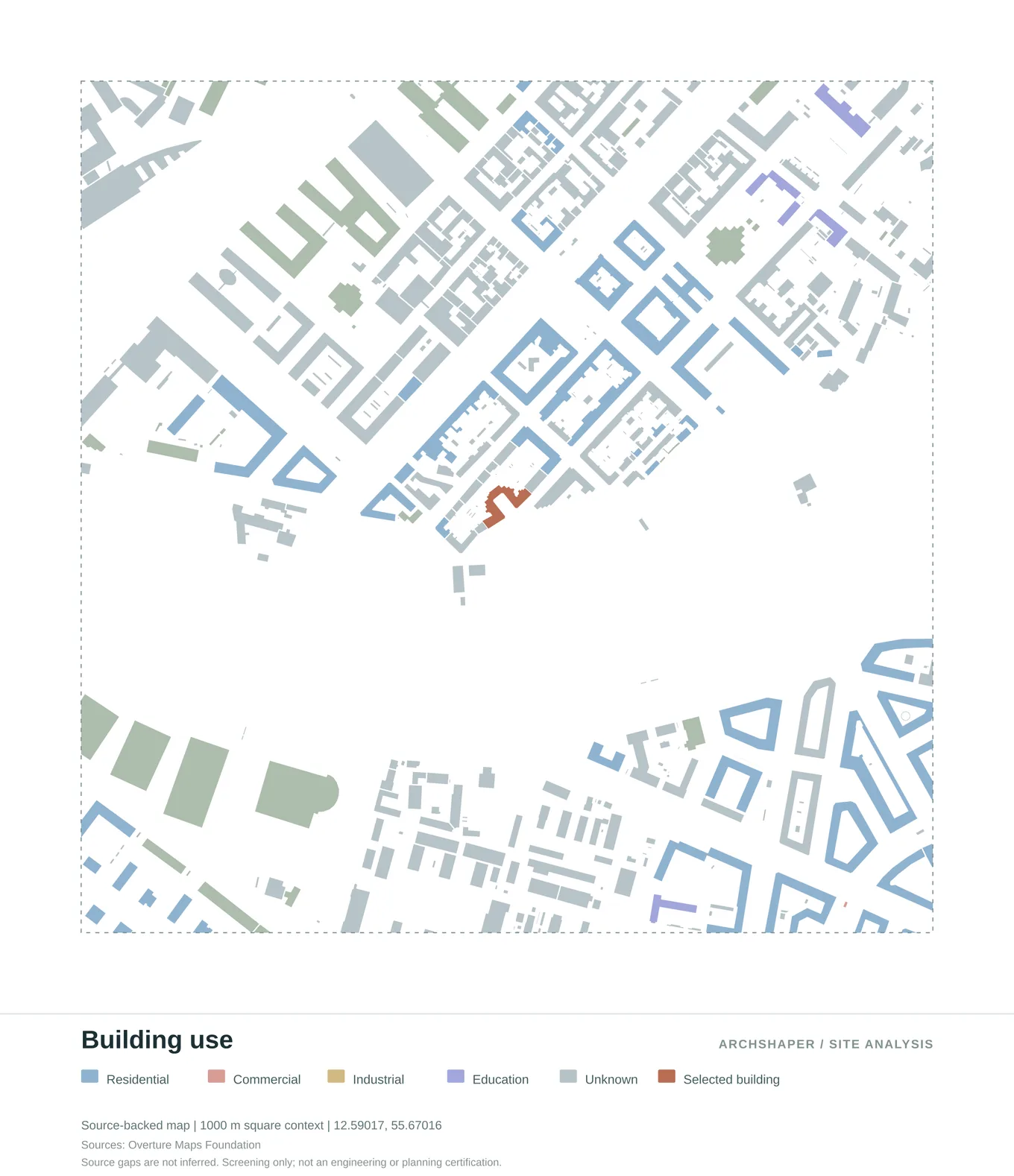
Mapped building functions with a clear colour-coded legend.
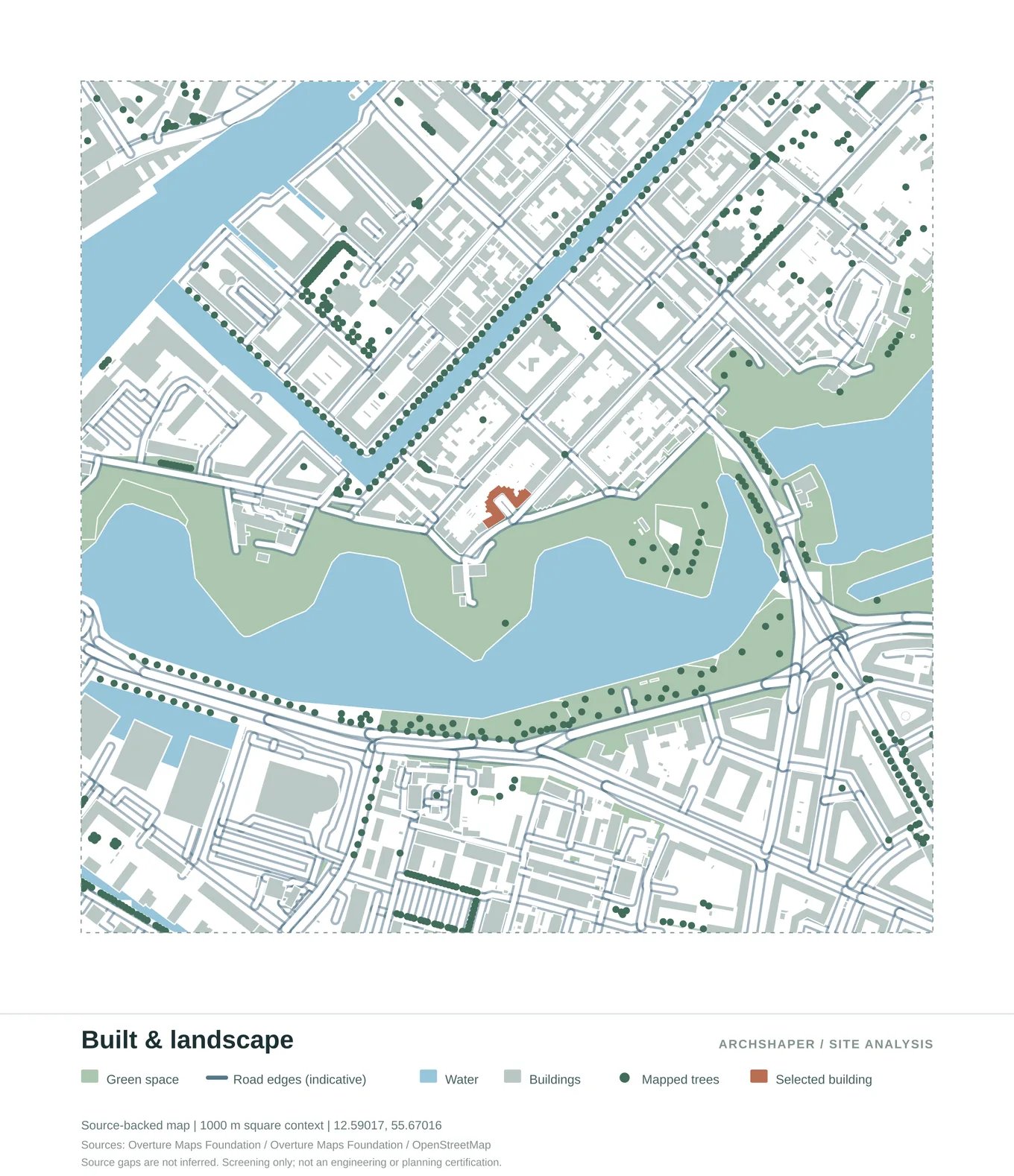
The relationship between urban fabric, vegetation and open space.
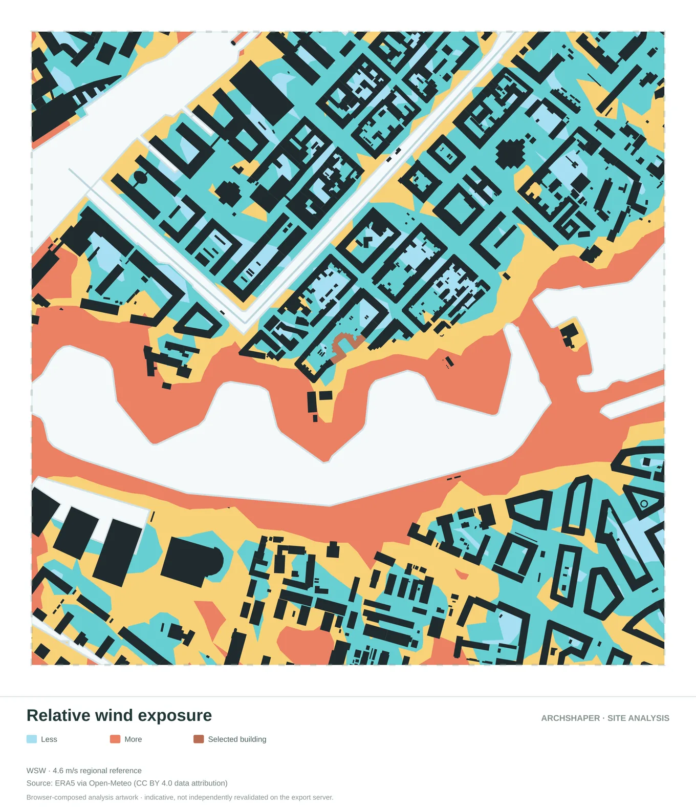
Compare mapped zones of lower and higher relative exposure.
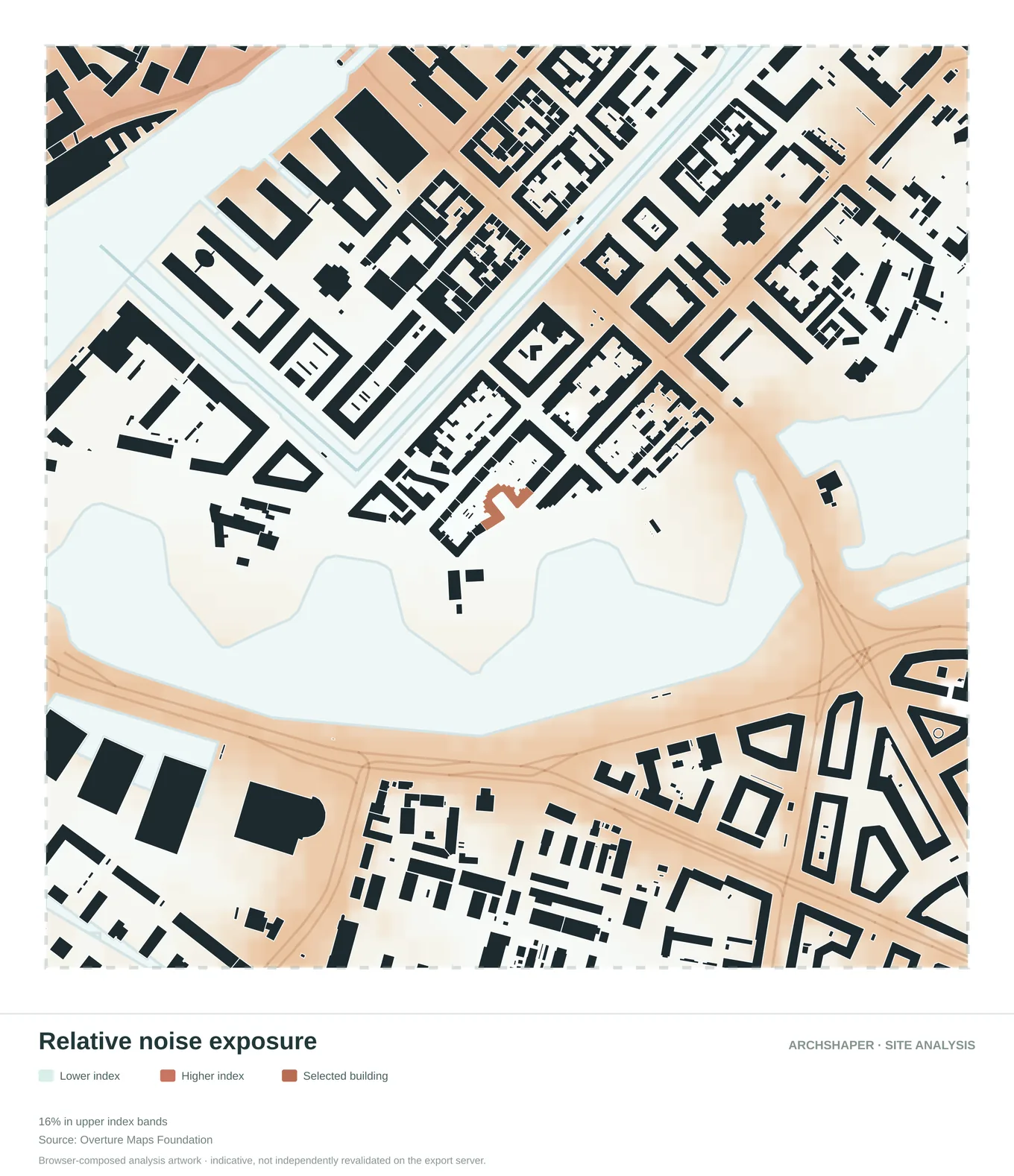
A relative visual comparison of exposure across the area.
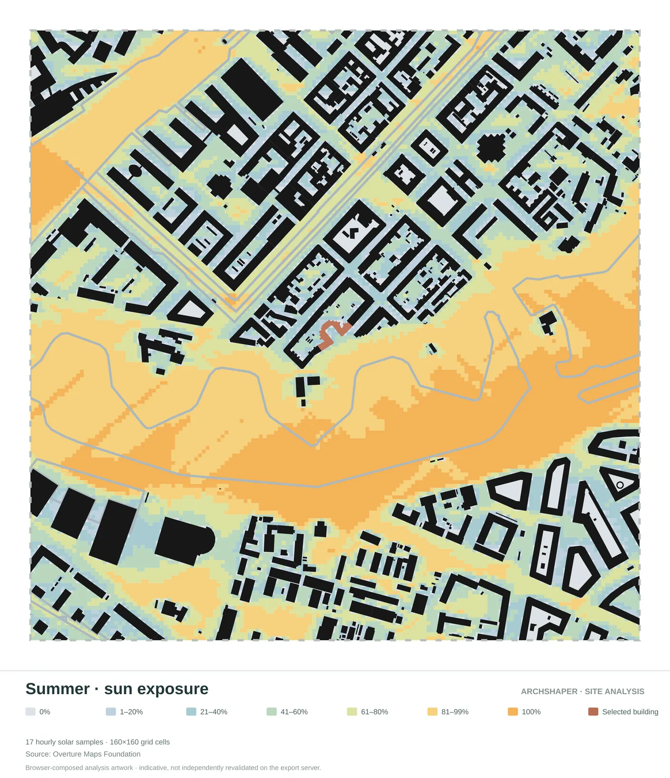
Illustrative sun-exposure patterns for a summer reference period.
How to read these diagrams
One project location
Select the study area once and compare the available diagrams in a common spatial context.
Built and natural context
Study urban form, transport networks, landscape, waterways and the character of the site.
Environmental studies
Explore available sun, shadow and regional wind diagrams with clearly stated data limitations.
Presentation-ready workflow
Preview diagrams, choose the views that answer your brief and see current export formats and credit requirements.
What should an architecture site analysis include?
Begin with the project site and its immediate urban relationships: access routes, surrounding buildings, land use, open space, vegetation and water. Then add topography and selected environmental studies when they affect the design proposal.
A strong site analysis does not display every available layer at once. It isolates specific questions in separate, comparable diagrams so the relationship between evidence and design response remains clear.
How to build a coherent site analysis sheet
Locate your project, confirm the site extent and review the available analysis categories. Pair a built-form map with circulation and natural-systems diagrams, then add weather-related information where it is relevant.
Keep your mapped extent, project-site marker and graphic language consistent. Use short legends and precise data attributions so that each diagram is useful on its own and as part of the full presentation.
Data sources and responsible use
Mapped features and environmental references can have different coverage, resolution and collection dates. Review the attribution and legend shown on each generated diagram and distinguish observed, mapped and estimated conditions.
Site-analysis illustrations help frame design research. They do not replace verified parcel surveys, local planning documentation, specialised daylight assessments, wind-tunnel tests or flood engineering studies.
Frequently asked questions
What is a site analysis tool for architects?
It is a way to study and communicate site conditions such as buildings, movement, water, vegetation and selected environmental factors before designing a project.
Can I use Archshaper for architecture school?
Yes. The diagrams can support studio projects, portfolios and early design reviews, provided important source data is checked.
Do I need GIS experience?
The workflow is built around selecting a location and interpreting diagrams, rather than setting up a GIS project from scratch.
Can I see export options before paying?
The Site Analysis export flow displays the currently available formats and credit cost for selected maps.
Does it replace engineering simulation?
No. Regional environmental visualisations and preliminary site diagrams are not substitutes for validated technical studies.