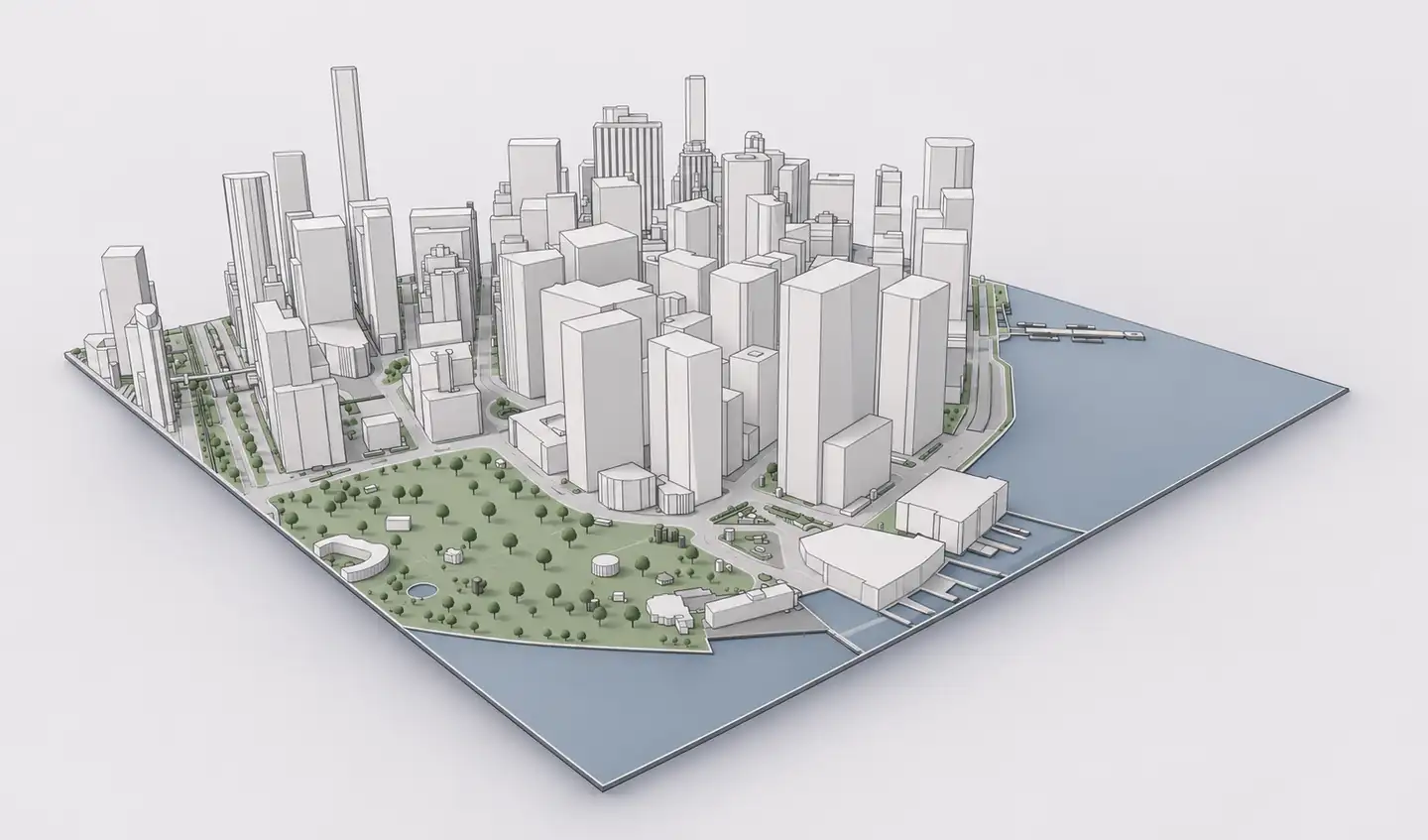
Archicad 3D site context
An architectural model is easier to evaluate when the setting is visible. Nearby building heights, street widths, landscape and changes in ground level can alter how the proposed building relates to its site. Archshaper creates a location-based 3D architectural context model, allowing architects to preview the surroundings before choosing an IFC4 reference export for Archicad. It is a way to establish conceptual site context quickly without manually rebuilding every street and neighboring mass.
Why use Archshaper?
See the architecture in context
Review the proposal's neighborhood as a coherent 3D setting rather than isolated outlines on a plan.
Select the most useful layers
Choose available buildings, streets, paths, vegetation and terrain according to the brief.
Bring context into BIM
Use Archicad's IFC import tools to place reference geometry beside the proposed design.
Four steps from map to Archicad
- Search the actual site
Enter your address or city location in the Archshaper 3D Map workspace.
- Define the context boundary
Select a compact area around the project or a larger urban extent for a competition.
- Inspect the 3D context
Review mapped building volumes, available height information and landscape layers.
- Export to Archicad
Choose IFC4 where enabled and check the model's placement, origin and units after import.
What is an architectural context model?
A context model represents the built and landscape surroundings that influence a design. It commonly includes neighboring buildings, roads, urban blocks, paths, ground form and important open spaces. This is distinct from the proposed building model, which contains the design geometry and project-specific BIM information.
For a housing proposal or public building competition, a context model helps explain scale, the street edge and the relationship between open space and built mass. Simplified surroundings are often sufficient for early design reviews but are not construction-grade records of adjacent properties.
From site information to a three-dimensional urban setting
Archshaper starts with available geographic data at a selected real-world location. Where mapped sources support them, the preview can show building footprints as volumes, a transportation network, water, green space and terrain. Some features may be absent or generalized, particularly where height or elevation data is incomplete.
Use the browser preview as a quality check before export. Examine the surrounding building masses and the coverage of the chosen context area. For presentations, choose a boundary that explains the site without adding unnecessary objects to the Archicad project.
Architectural context in Archicad: use IFC4 as a reference
Archicad supports importing IFC models with Open, Merge and Hotlink workflows. The IFC translator determines how elements, geometry and layers are interpreted. An Archshaper context export is designed to provide surrounding reference geometry; it should not be represented as a complete native BIM model of every existing building.
After import, check the project origin, reference level, orientation and units. Keep urban context separate from the building being designed, and verify that imported geometry appears correctly in the intended 2D and 3D Archicad views.
Why context matters for design and presentation
Context geometry can support massing comparisons, architectural axonometrics, competition narratives and early spatial studies. A neighboring building may define a street wall or influence perceived scale; a slope or green corridor may determine access and orientation. Having a reference model makes those relationships easier to discuss.
For exact building-height studies, daylight compliance or engineering design, use a verified survey and project-approved source information. The value of Archshaper's generated context is speed and clarity at the beginning of the design process.
Frequently asked questions
How do I add architectural context to an Archicad model?
Search your site in Archshaper 3D Map, preview the surrounding geometry, export IFC4 where enabled, and import the file into Archicad as reference context.
Can a context model include surrounding buildings and terrain?
Yes, when mapped building information and terrain coverage are available at the selected location.
Is this a native Archicad BIM model?
No. Imported IFC4 context provides reference geometry. It does not automatically create fully editable native Walls, Roofs or Mesh elements.
Can I inspect my architectural context before buying?
Yes. The browser preview is free, so you can review the extent and coverage before exporting.
Is the generated site context survey accurate?
No guarantee. Some heights and levels may be approximate; verify critical information independently.
What is the difference between context and a site model?
A context model emphasizes what surrounds the proposed design; a site model may also emphasize the selected plot, terrain and local site conditions. They can share source geometry, but serve different design questions.