Archicad 3D site context
A useful architectural site analysis is more than a map behind an Archicad model. It reveals what surrounds the project, how people move through it, which urban features matter and where landscape and environmental conditions influence design. Archshaper offers a Site Analysis workspace for readable 2D diagrams and a separate 3D Map editor for IFC4 context export to Archicad, giving designers both a graphic research workflow and a model-based workflow.
Site conditions, made visual
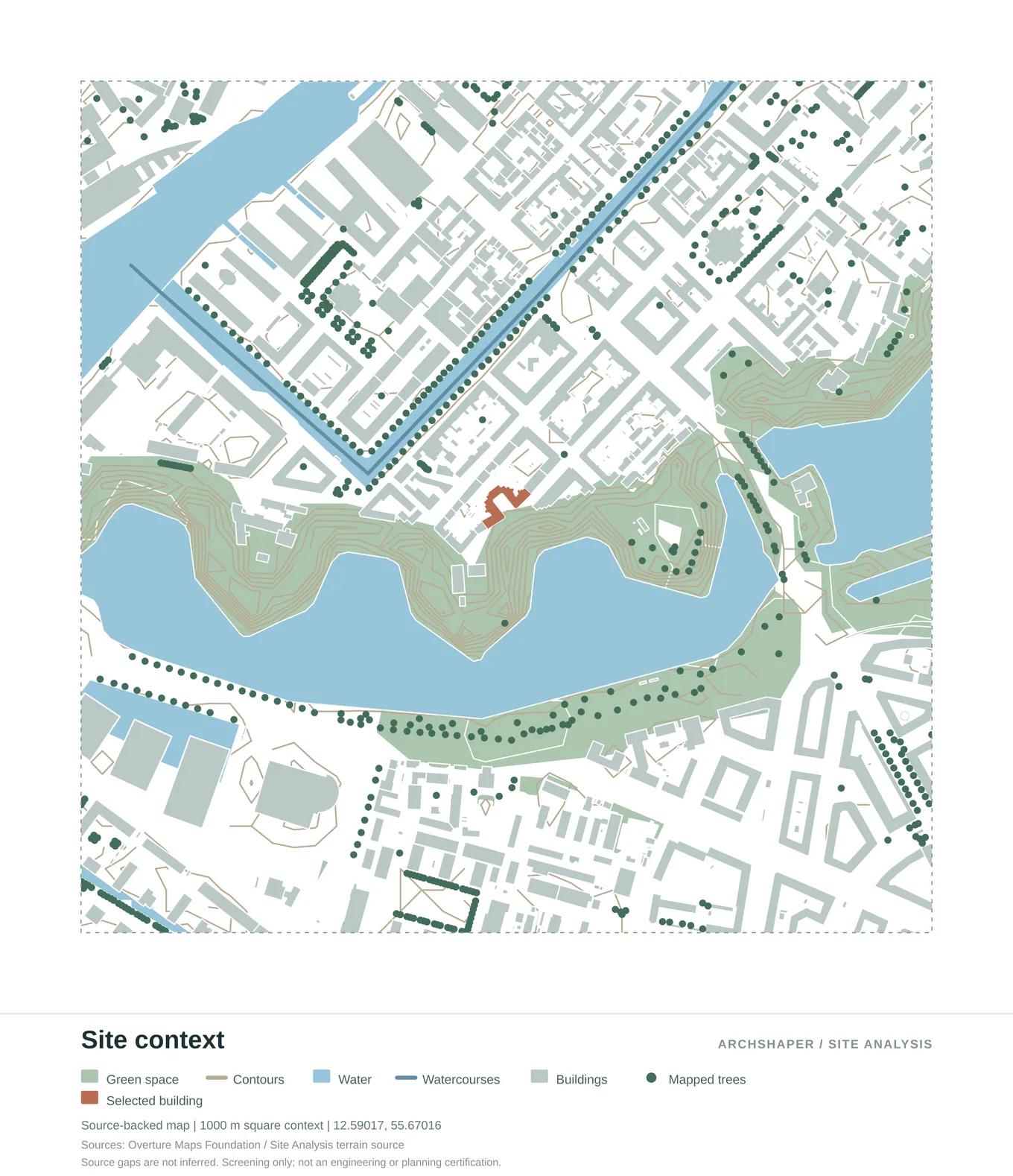
Site context
Buildings, streets, landscape, waterways and the selected project site in one map.
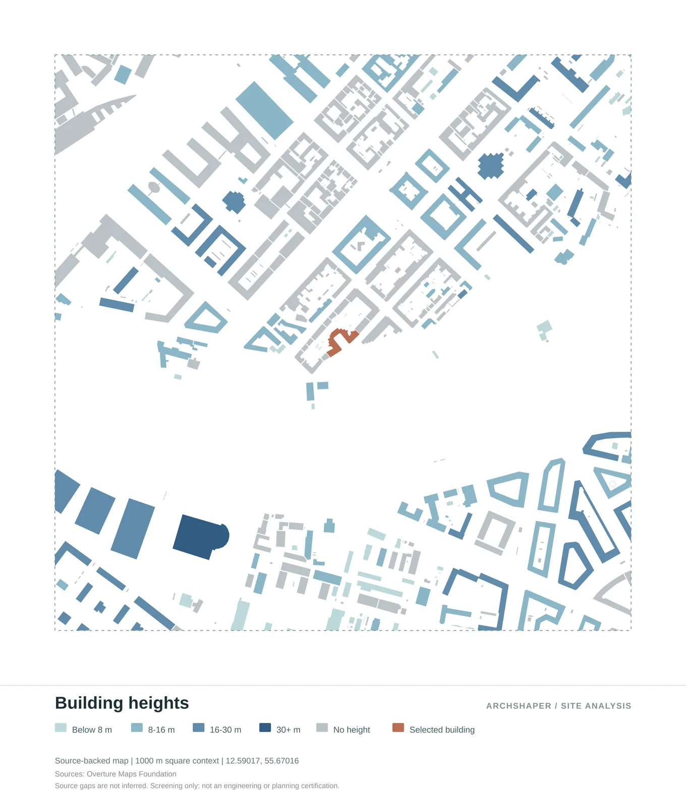
Building heights
Compare mapped building-height categories across the surrounding blocks.
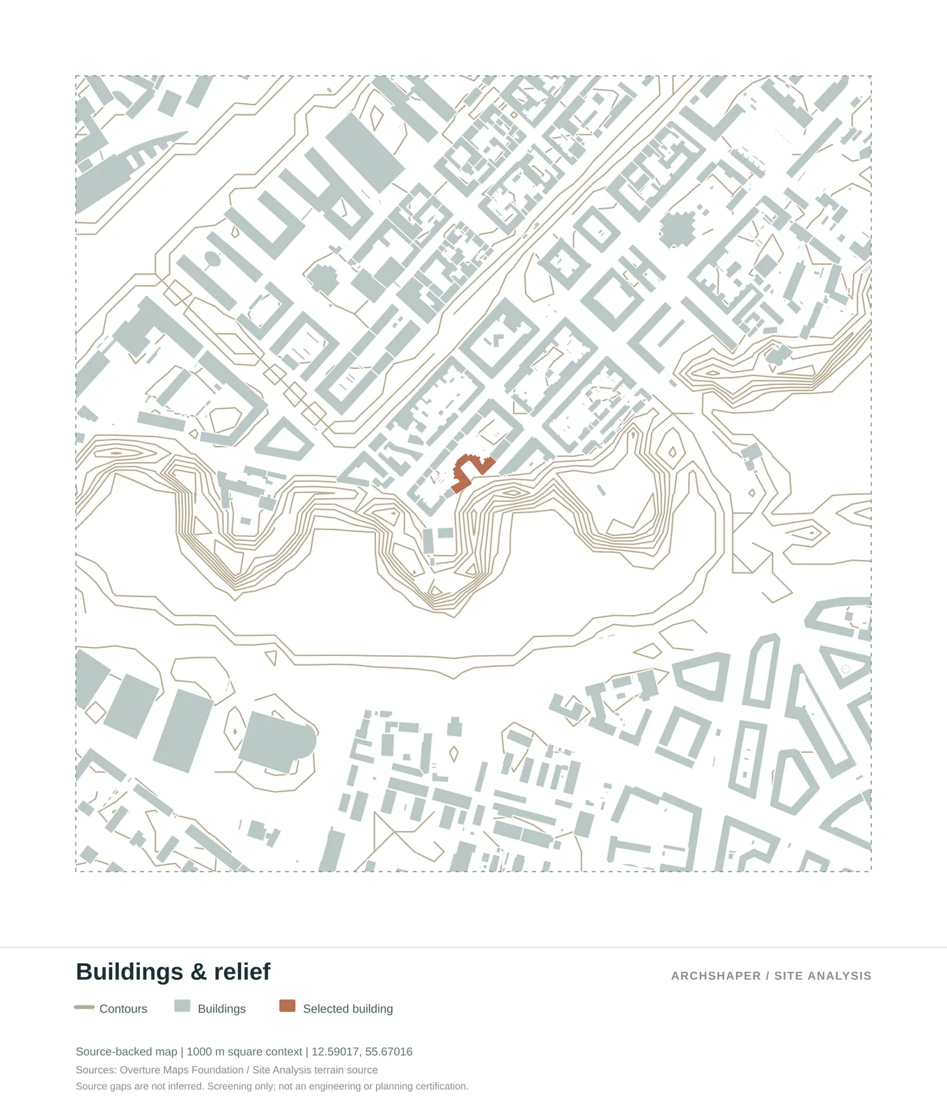
Buildings & relief
Terrain contours, building footprints and the site context.
Why use Archshaper?
Explain the place before the proposal
Read surrounding buildings, transport routes, landscape and water in site-analysis diagrams.
Study environmental questions
Use the available sunlight, wind, noise or other contextual illustrations as early-stage research.
Carry physical context into BIM
Generate a separate 3D site model and import the IFC4 reference geometry into Archicad.
Four steps from map to Archicad
- Select your study location
Start with the project site in Archshaper Site Analysis and inspect available diagrams.
- Understand the surroundings
Review site context, circulation, landscape, building use or available environmental studies.
- Make a 3D context model
Open 3D Map to build the surrounding building and terrain geometry.
- Coordinate in Archicad
Export IFC4 where enabled, import it and maintain your design as the native BIM source of truth.
Two complementary outputs: analysis diagrams and 3D context
The Site Analysis tool creates visual maps and diagrams that explain an architectural location. Depending on available data, these can include site context, surrounding building use, street networks, wind and noise illustrations, sun-related studies and other environmental layers. They support concept diagrams, portfolios and design presentations.
The separate 3D Map editor creates a contextual 3D model from geographic data. Its IFC4 export provides reference geometry for Archicad. The 2D diagrams are not themselves an automatic IFC or native BIM analysis object.
Questions worth asking before opening Archicad
Where does the site meet its surrounding street network? Which building scales define the area? Where are green spaces and water? Do mapped paths or topography suggest a particular approach to access and massing? These questions can be easier to answer in a focused diagram than inside a crowded 3D BIM model.
Use a consistent study boundary, clear legends and data-source notes. Do not present estimated site conditions as measured traffic, certified acoustic levels or legally verified boundaries.
A practical workflow from site research to BIM
Begin with architectural Site Analysis diagrams to establish the conditions relevant to the design brief. Export the relevant maps using the formats currently offered by Site Analysis. Next, create a matching site context in 3D Map. Review buildings, terrain and street layers, then export IFC4 for Archicad when it is enabled.
Keep exported diagrams in the presentation or research workflow and imported IFC geometry as 3D reference context in Archicad. This avoids suggesting that a 2D diagram is directly converted into native Archicad BIM geometry.
Limitations and professional verification
Mapped building heights and elevation surfaces may be estimated. Environmental diagrams are context studies and are not by themselves validated compliance simulations, noise measurements or climatic analyses. Confirm the sources and method before presenting conclusions.
For exact conditions, rely on current local surveys, planning documentation and appropriate specialist analysis. The role of Archshaper is to make first-stage site understanding faster and clearer.
Frequently asked questions
Can Archshaper make site analysis diagrams for an Archicad project?
Yes. Use Site Analysis for graphic research and the separate 3D Map editor for context geometry.
Can I import the analysis diagrams as IFC4?
No. The Site Analysis diagrams and the 3D IFC4 export are separate deliverables.
Can I bring the physical context into Archicad?
Yes. Export an IFC4 context model from 3D Map where enabled, then import it into Archicad.
Are wind and noise diagrams certified simulations?
No. Treat available environmental diagrams as early-stage context and verify specialist findings separately.
Can I preview 3D context before paying?
Yes. The 3D Map preview is available before exporting.
Which workflow should I use first?
Begin with a question-driven site analysis, then build a 3D reference model for the design issues that require spatial context.