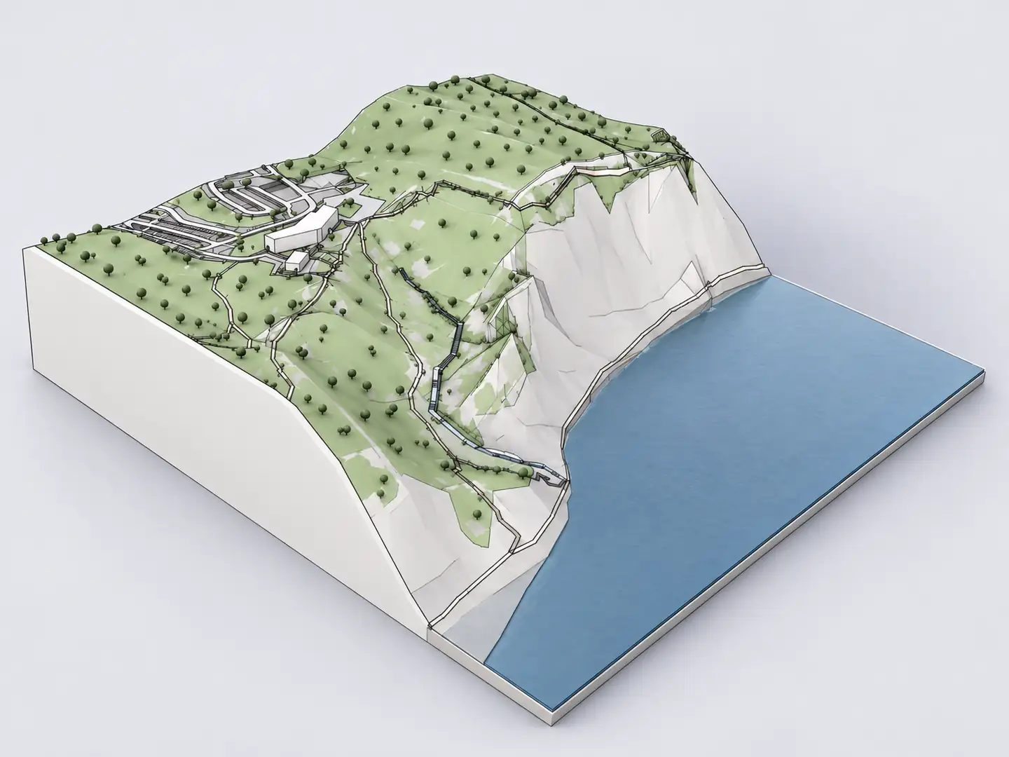
A useful terrain model explains how the ground affects architecture: access, placement, levels, visual relationships and the wider landscape. Archshaper uses available elevation data to generate the landform alongside surrounding mapped features, but it does not replace a survey. Understand the distinction between mesh and contours before importing the model.
What you can do
A 3D ground surface
Represent available elevation information as terrain geometry rather than tracing a slope from flat imagery.
Terrain and context together
Add nearby buildings, roads, paths, water and parks as available at the selected location.
Inspect difficult landscapes
Use the 3D browser preview to review steep slopes, coastlines and site coverage.
Keep design decisions grounded
Verify critical levels with survey information: the geographic elevation model is for context, not grading documentation.
Terrain mesh versus contour lines
A terrain mesh is a continuous surface assembled from connected faces. It represents the form of the ground in three dimensions, allowing architectural models to sit within a recognizable landform.
Contour lines connect points at the same elevation and help communicate slopes and level changes. A set of contour lines is not itself a finished surface mesh. If contour generation is available for your location, use it as analytical information alongside the ground surface.
Generate a terrain model for SketchUp
- Find the site — Search the project address or geographic location in Archshaper.
- Choose a relevant extent — Select enough surrounding landform to understand the site without unnecessarily adding distant terrain.
- Enable terrain and supporting layers — Where available, include contours, existing buildings, roads, vegetation and water.
- Inspect the free 3D preview — Rotate the model to assess slopes, terrain transitions, coastal cliffs and context coverage.
- Export and import — Download a format supported by your SketchUp version; verify scale, units and placement after importing.
Three situations where terrain changes the design
A house on a sloping site: existing levels affect access, apparent massing and how the ground floor meets the landscape. Use the model to explore broad options before surveying precise levels.
Coastal architecture: ridgelines, cliffs, shorelines and water edges influence views and the perceived height of a building. A 3D model makes the terrain-building relationship legible.
Campus and landscape design: slopes and changes in ground level affect paths, outdoor spaces and connections between buildings over a larger area.
Avoid the most common terrain modelling mistakes
Do not assume that elevation data captures every retaining wall, curb or recent earthwork. The source resolution may smooth sharp changes in grade, especially in urban and coastal settings.
Keep the generated area manageable. Dense terrain meshes, excessive vegetation and large geographic extents can increase file size and slow SketchUp. If you combine Archshaper with SketchUp Add Location, verify alignment and avoid duplicate terrain surfaces.
When to use measured survey data
Use authoritative survey data for finished floor levels, drainage, accessibility compliance, earthworks, construction details or regulatory submissions. Generated topographic context helps concept design but must not be used as a certified elevation survey.
Frequently asked questions
Can I create SketchUp terrain from a street address?
Yes. Select a location and generate terrain where supported elevation datasets are available.
Is a terrain mesh the same as contour lines?
No. The mesh is a connected 3D ground surface; contours are lines of equal elevation.
Can I include existing buildings?
Yes, where mapped building information is available.
Can the model represent cliffs and steep slopes?
It represents terrain supported by the available elevation source; small sharp features may be generalized.
Can I use it for accurate grading or construction?
No. Use verified measured survey and engineering data for those decisions.
Can I preview the terrain for free?
Yes. Archshaper offers free browser-based 3D previews.
Design with the real landform in mind
Generate a topographic context model, examine your project site and then move into SketchUp with the appropriate available export.
Generate your terrain model